RECENT ARTICLES

Tracking California’s sinking coast from space: Implications for relative sea-level rise
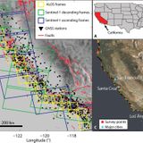
Coastal vertical land motion affects projections of sea-level rise, and subsidence exacerbates flooding hazards. Along the ~1350-km California coastline, records of high-resolution vertical land motion rates are scarce due to sparse instrumentation, and hazards to coastal communities are underestimated. Here, we considered a ~100-km-wide swath of land along California’s coast and performed a multitemporal interferometric synthetic aperture radar (InSAR) analysis of large datasets, obtaining estimates of vertical land motion rates for California’s entire coast at ~100-m dimensions—a...…Coastal vertical land motion affects projections of sea-level rise, and subsidence exacerbates flooding hazards. Along the ~1350-km California coastline, records of high-resolution vertical land motion rates are scarce due to sparse instrumentation, and hazards to coastal communities are underestimated. Here, we considered a ~100-km-wide swath of land along California’s coast and performed a multitemporal interferometric synthetic aperture radar (InSAR) analysis of large datasets, obtaining estimates of vertical land motion rates for California’s entire coast at ~100-m dimensions—a...WW…
- Total 1 items
- 1