RECENT ARTICLES

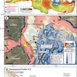
Seafloor microplastic hotspots controlled by deep-sea circulation
What controls the distribution of microplastics on the deep seafloor? Kane et al. show that the answer to that question is more complicated than particles simply settling from where they are found on the sea surface (see the Perspective by Mohrig). Using data that they collected off the coast of Corsica, the authors show that thermohaline-driven currents can control the distribution of microplastics by creating hotspots of accumulation, analogous to their role in causing focused areas of seafloor sediment deposition. Such currents also supply oxygen and nutrients to deep-sea benthos, so...…What controls the distribution of microplastics on the deep seafloor? Kane et al. show that the answer to that question is more complicated than particles simply settling from where they are found on the sea surface (see the Perspective by Mohrig). Using data that they collected off the coast of Corsica, the authors show that thermohaline-driven currents can control the distribution of microplastics by creating hotspots of accumulation, analogous to their role in causing focused areas of seafloor sediment deposition. Such currents also supply oxygen and nutrients to deep-sea benthos, so...WW…

Tracking California’s sinking coast from space: Implications for relative sea-level rise
Coastal vertical land motion affects projections of sea-level rise, and subsidence exacerbates flooding hazards. Along the ~1350-km California coastline, records of high-resolution vertical land motion rates are scarce due to sparse instrumentation, and hazards to coastal communities are underestimated. Here, we considered a ~100-km-wide swath of land along California’s coast and performed a multitemporal interferometric synthetic aperture radar (InSAR) analysis of large datasets, obtaining estimates of vertical land motion rates for California’s entire coast at ~100-m dimensions—a...…Coastal vertical land motion affects projections of sea-level rise, and subsidence exacerbates flooding hazards. Along the ~1350-km California coastline, records of high-resolution vertical land motion rates are scarce due to sparse instrumentation, and hazards to coastal communities are underestimated. Here, we considered a ~100-km-wide swath of land along California’s coast and performed a multitemporal interferometric synthetic aperture radar (InSAR) analysis of large datasets, obtaining estimates of vertical land motion rates for California’s entire coast at ~100-m dimensions—a...WW…

Seafloor microplastic hotspots controlled by deep-sea circulation
You are using an old browser, click here to download PDF PDF ContainerVol 368, Issue 6490© 2020 . All rights reserved. AAAS is a partner of , , , , , and .Science ISSN 1095-9203.…You are using an old browser, click here to download PDF PDF ContainerVol 368, Issue 6490© 2020 . All rights reserved. AAAS is a partner of , , , , , and .Science ISSN 1095-9203.WW…
- Total 3 items
- 1